I decided to officially archive this blog on the day my DPhil was confirmed. But I have waited for the electronic publication of my thesis, Interrogating Archaeological Ethics in Conflict Zones: Cultural Heritage Work in Cyprus, to announce the archiving. From now on, I will blog at Conflict Antiquities.
Saturday, August 27, 2011
Wednesday, December 16, 2009
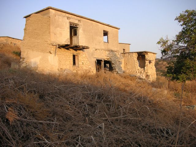
Evretou: abandoned village, occupied
[Thanks to Dave S's comment on the Evretou photo blog, I will try to give each site photo blog a proper introduction; until then, I'll cross-post the introductory posts from Cultural Heritage in Conflict (or samarkeolog).]
I've just put up one site from my amateur surveys* in Cyprus: it's Evretou, which was long a Turkish Cypriot village in western Cyprus, until, according to Jack Goodwin (1978: 296), the United Nations Force In Cyprus (UNFICYP) transferred the villagers to northern Cyprus in the autumn of 1975, after which, some Greek Cypriot refugees were settled there (temporarily).
One of the disadvantages of conducting my research (overwhelmingly) in southern Cyprus, then (overwhelmingly) in northern Cyprus, is that the information gathered is predominantly about the first place, then the second; so, now, most of my information is about southern Cyprus, although I deal with both equally.
I noticed, after I put up the notes about Alevga and Mansoura, that it might appear as if I were biased against the South, which is why I put up the notes about Agia Irini/Camlibel and Mallia, demonstrating, first, that there have been negative acts by nationalist groups in each community against each other and, second, that my work will address the negative acts of each group. I am not a "lover" of any side, as it has been said.
* I am an archaeologist, or cultural heritage worker, but I have not been trained in survey work and am not a surveyor. When I survey - inspect? - sites, I could not and would not try to plan them or their parts - the family homes, community fountains and so on - properly.
When I inspect the sites, I want to find out and record what character they had before and have now, what has happened to them and what is happening to them. It would be too much to claim they are examples of historic landscape characterisation, but I strive to document (what I judge to be) the central features and to capture (what I sense to be) the feeling of the place.
The photographic surveys:
Goodwin, J C. 1978: An historical toponymy of Cyprus. Nicosia: Jack C. Goodwin.
[Poor phrasing corrected on the 30th of March 2007: I was worried that "talking to their residents (hopefully, in the future, their former residents)..." sounded like I wanted Evretou's current residents to become its former residents, when what I meant was that I wanted to talk with the people who had lived in Evretou before it became an abandoned village as well as those who had lived there since it was re-occupied.]
[This was originally posted on samarkeolog on 28th November 2006.]
[Thanks to Dave S's comment on the Evretou photo blog, I will try to give each site photo blog a proper introduction; until then, I'll cross-post the introductory posts from Cultural Heritage in Conflict (or samarkeolog).]
I've just put up one site from my amateur surveys* in Cyprus: it's Evretou, which was long a Turkish Cypriot village in western Cyprus, until, according to Jack Goodwin (1978: 296), the United Nations Force In Cyprus (UNFICYP) transferred the villagers to northern Cyprus in the autumn of 1975, after which, some Greek Cypriot refugees were settled there (temporarily).
One of the disadvantages of conducting my research (overwhelmingly) in southern Cyprus, then (overwhelmingly) in northern Cyprus, is that the information gathered is predominantly about the first place, then the second; so, now, most of my information is about southern Cyprus, although I deal with both equally.
I noticed, after I put up the notes about Alevga and Mansoura, that it might appear as if I were biased against the South, which is why I put up the notes about Agia Irini/Camlibel and Mallia, demonstrating, first, that there have been negative acts by nationalist groups in each community against each other and, second, that my work will address the negative acts of each group. I am not a "lover" of any side, as it has been said.
* I am an archaeologist, or cultural heritage worker, but I have not been trained in survey work and am not a surveyor. When I survey - inspect? - sites, I could not and would not try to plan them or their parts - the family homes, community fountains and so on - properly.
When I inspect the sites, I want to find out and record what character they had before and have now, what has happened to them and what is happening to them. It would be too much to claim they are examples of historic landscape characterisation, but I strive to document (what I judge to be) the central features and to capture (what I sense to be) the feeling of the place.
The photographic surveys:
- first, help me to remember them and their significant features and to learn about them;
- second, help me to talk about them with other people and to present them publicly; and
- third, help me to prove their pasts and presents and predict their futures.
Goodwin, J C. 1978: An historical toponymy of Cyprus. Nicosia: Jack C. Goodwin.
[Poor phrasing corrected on the 30th of March 2007: I was worried that "talking to their residents (hopefully, in the future, their former residents)..." sounded like I wanted Evretou's current residents to become its former residents, when what I meant was that I wanted to talk with the people who had lived in Evretou before it became an abandoned village as well as those who had lived there since it was re-occupied.]
[This was originally posted on samarkeolog on 28th November 2006.]
Friday, November 24, 2006

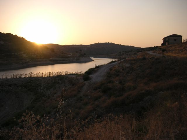
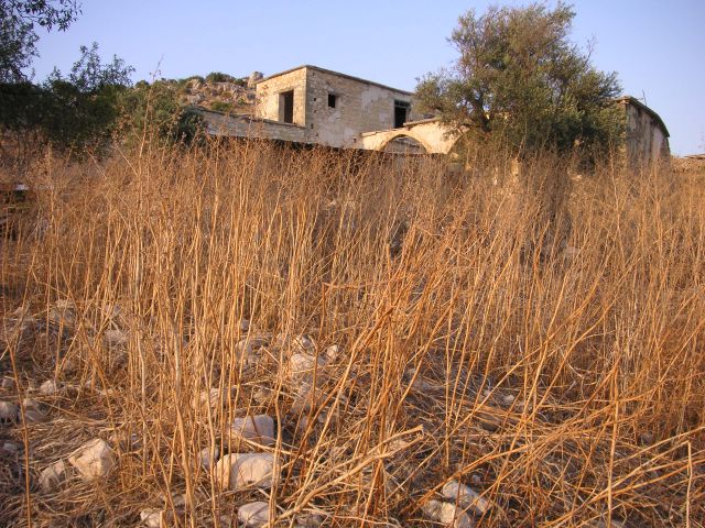
Evretou building 4c: everything in shadow, I could only see the scrub, the building on the hill, the water shimmering and the sun setting and could imagine it being a tranquil village in the Lake District.
As always during my surveys, I was limited by the light, which was sometimes so strong as to make taking photographs impossible (as it made the shot white out) and which was always a cap on how long and how late I could work; still, it meant I always got home in time for a late supper.

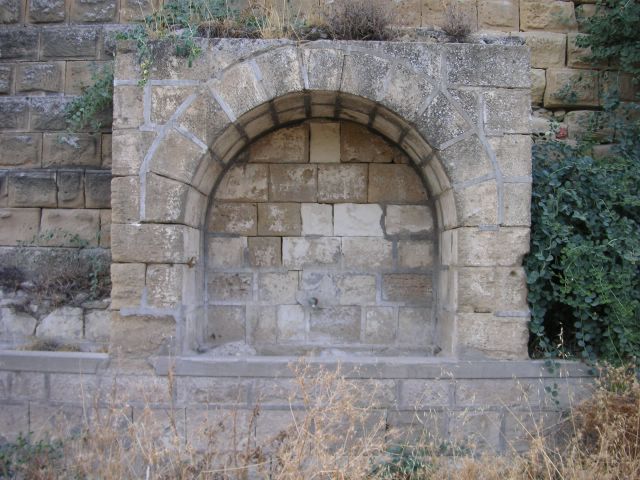
Evretou fountain 2b: this is just a close-up of this public fountain, which was intended to show the fountain, but make the "WSID 1948" mark more visible; it didn't really work.
[Updated on 21st September 2009.]
The WSID was the British colonial Water Supply and Irrigation Department.

Evretou fountain 2a: this public fountain was also built in 1948 by the colonial British WSID(?), cast in concrete against a stone wall, now being enveloped by grasses and shrubs.
[Updated on 21st September 2009.]
The WSID was the British colonial Water Supply and Irrigation Department.


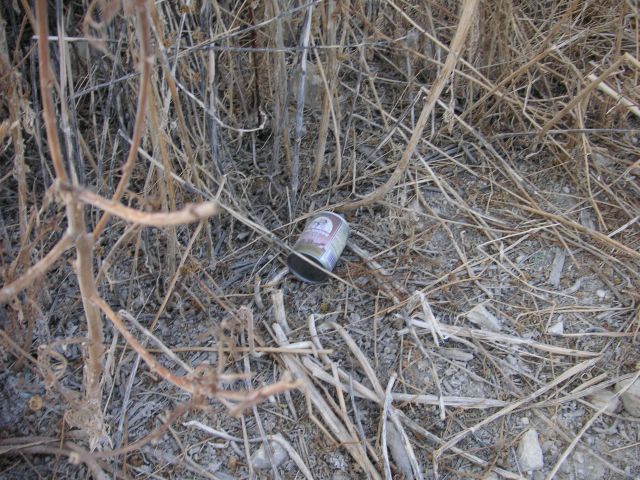
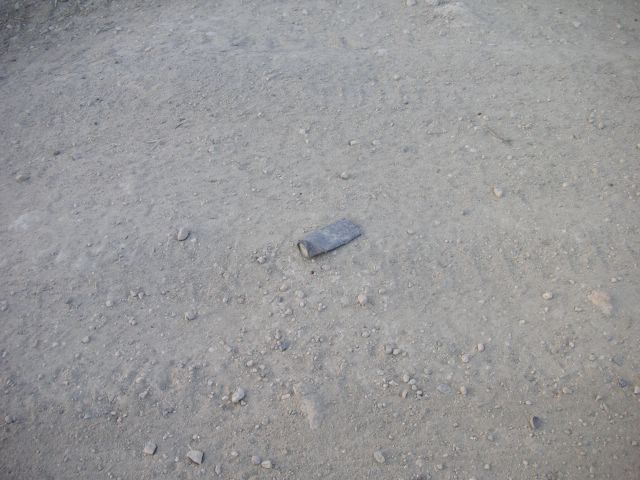
Evretou artefact 1: just as I started hearing shots going off around the valley and walking back to the car in case I was in the hunting grounds, I saw this spent cartridge.
When finding the material remains of hunting trips, the parties tend to deposit a typical assemblage of spent cartridges, crushed cans of coffee (Evretou artefact 2) and beer (Evretou artefact 3) (and snacks packaging), either where they base themselves or along the sides of the paths between those bases.
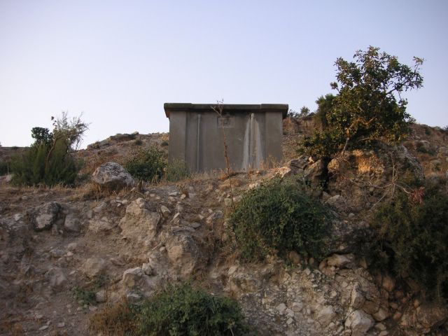
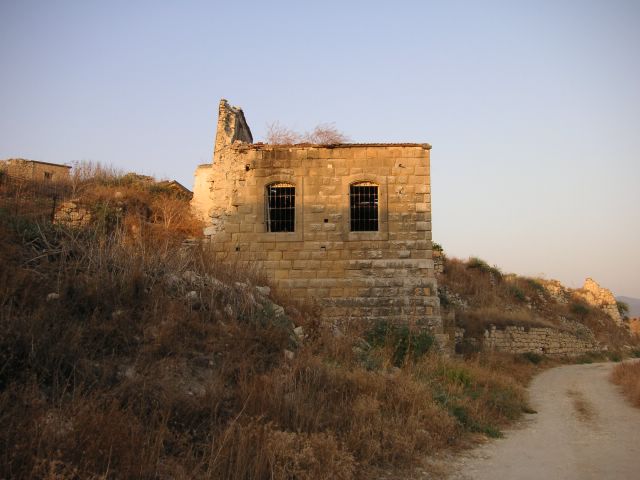
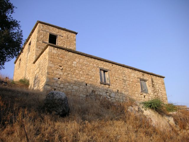
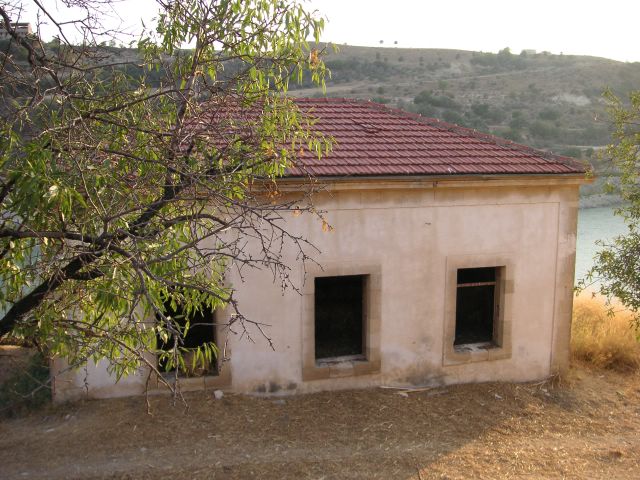
Evretou building 14: I don't know what this is, precisely (water treatment, desalination or sewage treatment?), but it was installed by the colonial British WSID (Works and Social Insurance Department?) in 1948. These structures and the public fountains are frequently the only fully intact buildings left in the abandoned villages.
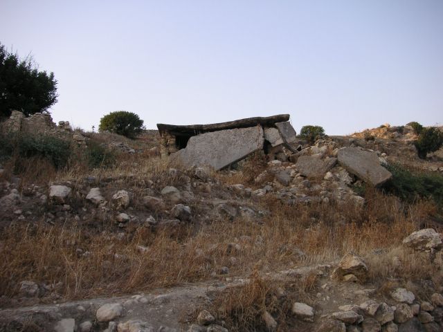
Evretou buildings 13: apart from the modern materials, this now looks more like a prehistoric, megalithic dolmen portal tomb than it does a twentieth-century home.
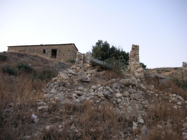
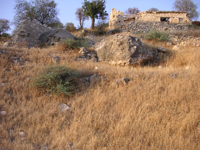
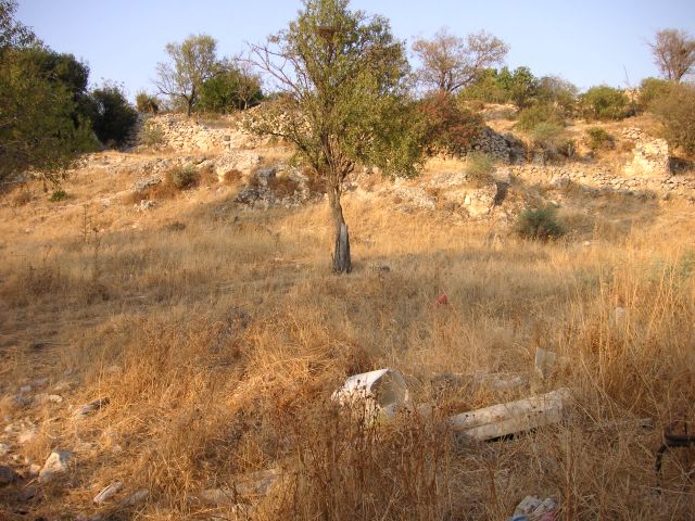
Evretou buildings 12: this site also reminded me of Kosova/Kosovo, as it was being swallowed by natural materials, entering the ground, in the process of becoming an archaeological deposit, as many places in Kosovo were.
As these materials fade, so do the memories they hold. It is already possible to imagine future archaeologists excavating these remains and trying to piece together what happened, but how much could they learn and how convincing would their narrative of the site be? If we could maintain these sites, we could maintain those memories and convincing proof of the histories we need to tell.
Evretou buildings 11
[This post was updated on 18th August 2009.]
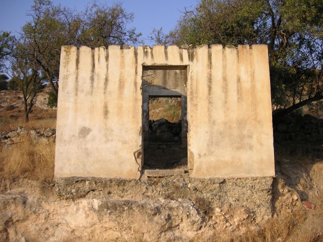
On Cyprus Temples, the bicommunal architectural survey recorded Evretu Mosque as:
Structure: Repaired;
Facade: Repaired;
Roof: Repaired;
Interior: Repaired; and
Decoration: Ruin.


Evretou building 9e: looking at the bricks forming the left corner of the structure, one of them has a cross carved into its left corner; in the photo, the graffiti is "pointed to" by the roof of the building in the background. (I don't know what to make of the smear of tar(?) and the scratches under, in or through it.)
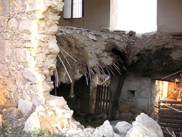

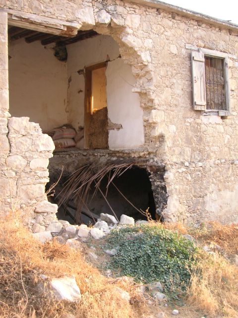
Evretou building 9a: this house too was being used as a straw (and sand or cement?) store; however, the thing that grabbed my attention was this gaping hole in the wall and floor.
The material surrounding the hole still sturdy, the wall seems to have been punctured, the floor breaking up and falling down with it (one benefit for people studying it being the "fan" of material displaying the many phases of its construction, most visible in the photo of Evretou building 9d). I still want to know: who or what did this (with what, how) and why?

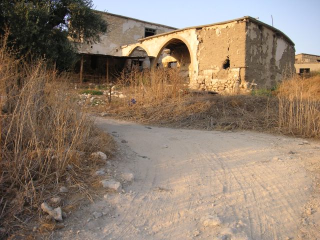
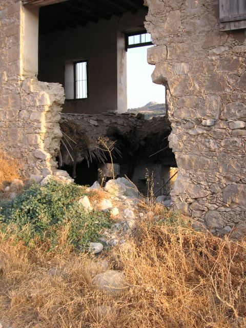
Evretou building 8b: I have seen the covered outdoor area, the front of which is formed by the double arches, in homes that are still lived in, where they provide a cool, shaded place for people to work, friends to talk and children to play.
Now, the cover half-gone, the mudbrick disintegrating, the building is fenced in and the home is, as far as I can tell, an animal pen.
Evretou building 7c: just visible in the background on the far right of the photo of Evretou buildings 7a, the quality of the building shows that it has been restored or maintained, though I don't know whether that was by Greek Cypriot refugees arriving after the war, or farmers, hunters, holidaying squatters or others staying at the site more recently.
Evretou buildings 7b[: homes]
[Updated on 20th August 2009.]
Turkish Cypriot Zen said this was his/her family home.

Evretou buildings 7a: of the central building in this set, only the two back walls and the floor remain in the present, creating a real version of the plans commonly drawn to show how a building would have looked inside in the past (by removing the roof and front walls that would be in the way of the viewers).


Evretou building 4b: this shows the abandoned [school] building
[Updated on 20th August 2009.]
Thanks to Zen, I now know this was the school.
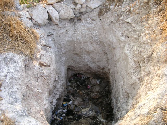
Evretou building 5: more of an excavation than a construction, this (storage?) pit has been cut into the bedrock.
As I had approached, the stench of rotting animal carcasses had become stronger and, with the desolation of this ghost town, it had reminded me of those dead places in Kosova/Kosovo. Putting my hand through the strap of my camera so I couldn't drop it down there, I held it over the pit, took the photo and retreated.

Subscribe to:
Posts (Atom)


